Built for storm professionals
Every feature is designed to help you find, verify, and act on storm data faster.
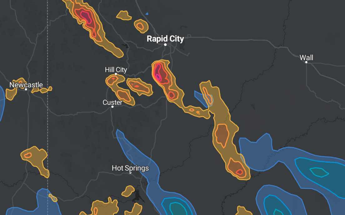
Radar-Based Hail & Wind Swaths
Hail size and wind gust estimates derived directly from NEXRAD radar data, rendered as polygon swaths on an interactive map. See exactly which streets and neighborhoods were impacted.
Storm Date Finder
Navigate to any location and instantly see a list of dates on which storms impacted that area. Click a date to load the swaths from that event — no guessing, no searching through old records.
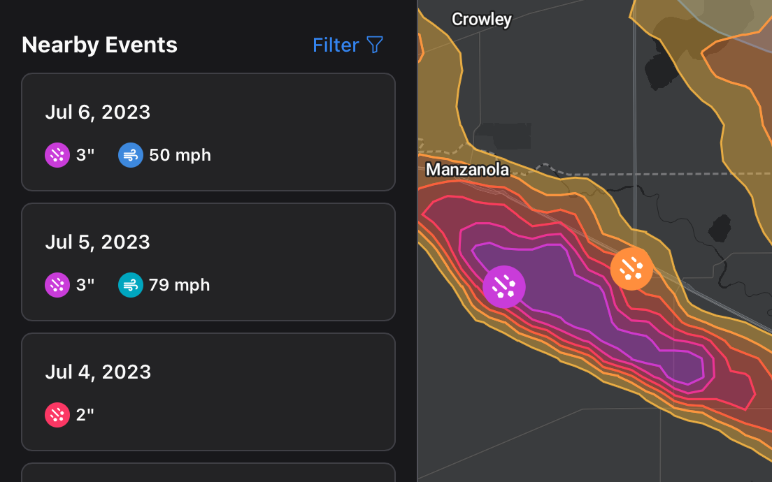
SPC & mPING Storm Reports
Official Storm Prediction Center reports and crowd-sourced mPING reports displayed as point data alongside radar swaths. Cross-reference multiple data sources on a single map.

Company & Team Management
Create a company, invite team members, and manage billing centrally. Admins control seat-based subscriptions and can pause or resume access for individual members.